
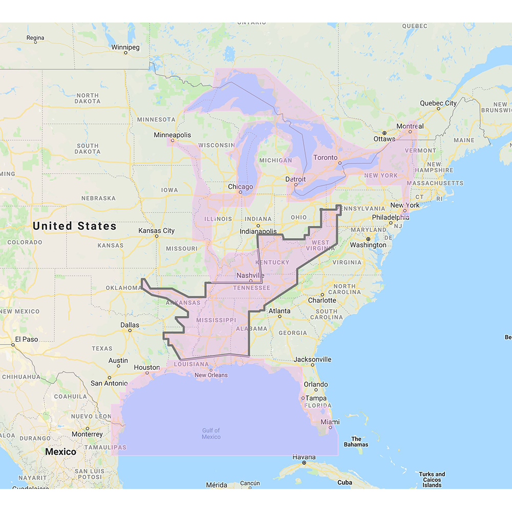
Furuno Gulf of Mexico Great Lakes & Rivers Vector Charts
- Full name
- FURUNO GULF OF MEXICO GREAT LAKES & RIVERS VECTOR CHARTS
- Mfg part #
- MM3-VNA-023
- SKU
- 72869
Backorder: ships once restocked by the manufacturer. We’ll email you if there’s a delay.
🚚 Free shipping over $100 This item ships free.
Returns and warranty for Furuno go directly through the manufacturer. Details
Secure checkout · prices verified at checkout
Genuine parts from authorized distributors. Questions? getboatparts@gmail.com
- Returns via manufacturer
About this part
The Furuno Gulf of Mexico Great Lakes & Rivers Vector Charts is a genuine Furuno part (manufacturer part # MM3-VNA-023) in our Furuno range under Cartography. It's currently on backorder. Order now to reserve the next shipment.
Manufacturer description
Gulf of Mexico, Great Lakes & Rivers - Vector Chart & Standard Resolution Satellite Photos for Part of the Great Lakes - Unlock Code
**SYSTEM ID REQUIRED TO RECEIVE UNLOCK CODE**
C-MAP Wide Chart - Gulf of Mexico, Great Lakes & Rivers. Vector charts & standard resolution satellite photos for part of the Great Lakes.
This Chart Pack includes vector charts for Gulf of Mexico, Great Lakes, and Rivers, plus standard resolution satellite photography for part of the Great Lakes. C-MAP chart data is used and converted to the TimeZero format.
These C-MAP charts are comprised of the same cartographic chart information found in C-MAP MAX and C-MAP MAX PRO charts.
To purchase this chart pack for NavNet 3D, TZT or TZT2, you will need to provide your NavNet system ID to your local authorized Furuno dealer. The system ID can be located under the “My NavNet” menu.
 WARNING: This product can expose you to chemicals which are known to the State of California to cause cancer, birth defects or other reproductive harm. For more information go to P65Warnings.ca.gov.